THE MOBACT Geophysics recently undertook a critical geophysical survey for the Port of Thessaloniki, aiming to detection and mapping of the underground networks around the perimeter of a historic building to be reconstructed. This effort was vital for the safe and effective reconstruction of the building, ensuring the integrity of the existing infrastructure.
At the same time, the deliverable results constitute a valuable presumption (Asset) for the technique documentation (Documentation) of the client, adding added value to the entire project.
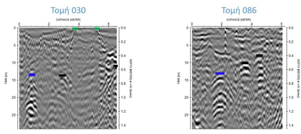
The research focused on identifying the position, of route and his depth of the following underground networks:
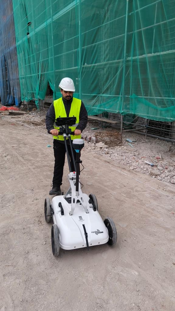
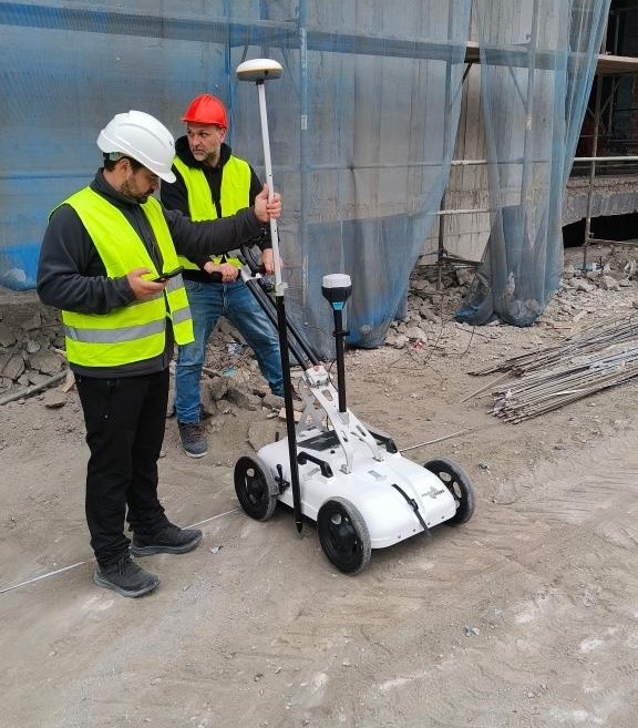
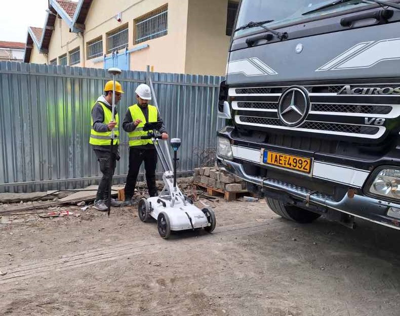
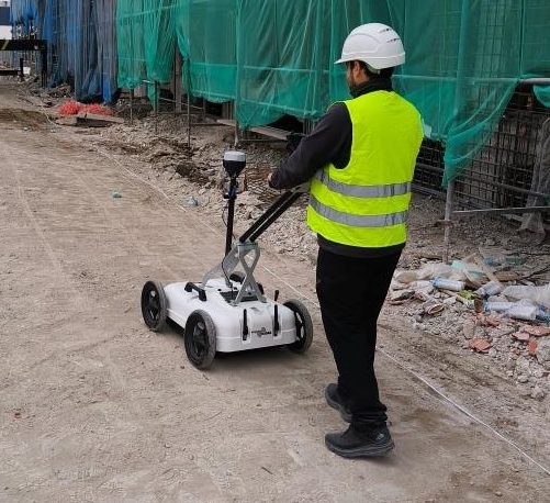
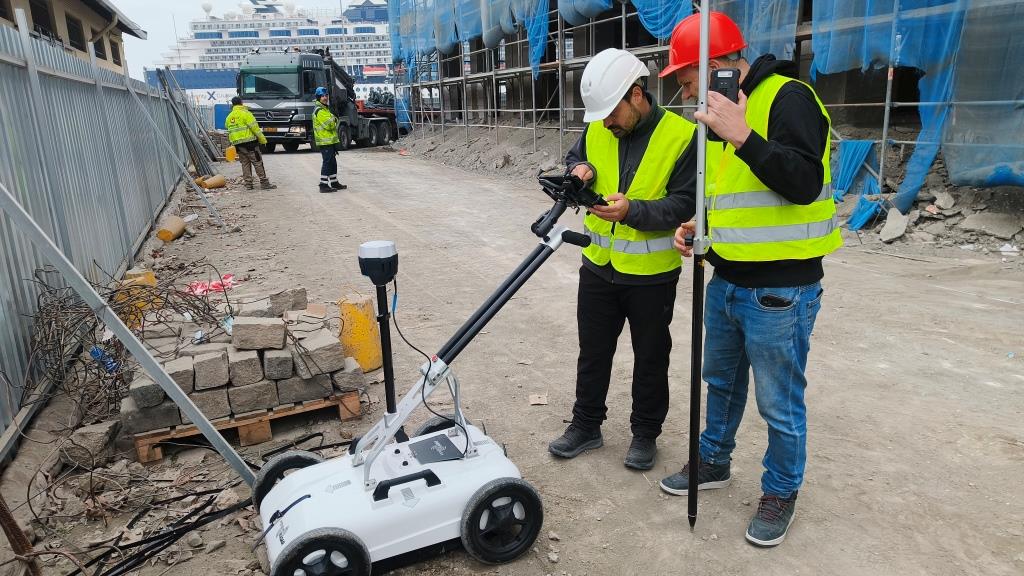
To achieve the research objectives, the Ground Penetrating Radar (GPR) method was applied, a non-destructive geophysical technique which uses high-frequency radar pulses to image the subsurface.
The method was chosen because of its ability to provide accurate and detailed information on the presence and Mapping of underground networks and structures, without affecting their integrity. The use of GPR allows for rapid data collection, reducing the time and resources required to complete the survey.
MOBACT substantially differentiates itself in the Greek market thanks to its specialized know-how and unique ability to present final results with absolute reliability, accuracy and methodicality.
Our experience in management complex geophysical surveys, the modern equipment and the specialization of our technical staff, ensure the high quality of the services provided, highlighting MOBACT as a valuable and reliable partner for every demanding project.
The success of the project is largely due to the perfect cooperation between our team and the engineers of the Port of Thessaloniki, as well as the collaborating companies Redex SA and Hill International SA.

Their active participation, the provision of critical information and their continuous support contributed decisively to the accurate and efficient conduct of the research. This collaboration ensured that the results of the research will be used in the best possible way to support the reconstruction work of the building.
The successful completion of the geophysical survey using the GPR method highlights the importance for accurate mapping of underground networks before construction work began. Collaboration with the project engineers was key to the success of the project, ensuring the safety and efficiency of future reconstruction work.
THE MOBACT Geophysics constitutes the specialized branch of geophysical research of MOBACT, offering advanced subsurface mapping and analysis services.
By using leading technologies, such as Ground Penetrating Radar (GPR) and other geophysical methods, we ensure accurate and reliable data for civil engineering projects, constructions, geotechnical studies and archaeological research.
Geophysical studies help us in non-destructive exploration of the subsoil, revealing important information about infrastructure, soil conditions and potential risks that may affect a project.
THE MOBACT Geophysics uses latest generation equipment, ensuring accuracy and reliability in the results.
Ground Penetrating Radar (GPR): It provides high-resolution images of the subsurface, ideal for detecting underground infrastructure and archaeological finds.
Electromagnetic Methods (EM): They detect conductive materials, such as metal pipes and cables, even at long distances.
Geoelectric Methods: They are used to locate underground aquifers, cracks and weak soil zones.
MOBACT has an experienced team of specialized scientists and engineers from National Technical University of Athens that use the most modern mapping technologies. Our services are tailored to the needs of each project, ensuring high quality and efficiency.
If you need a geophysical study with the use of GPR for your project, contact us today. Send email to in**@mo****.gr or call us at +302102519273 for more information and to schedule a free estimate.
